Azure Maps
An Azure service that provides geospatial APIs to add maps, spatial analytics, and mobility solutions to apps.
716 questions
This browser is no longer supported.
Upgrade to Microsoft Edge to take advantage of the latest features, security updates, and technical support.
' cx='32' cy='32' r='32' /%3E%3Ctext x='50%25' y='55%25' dominant-baseline='middle' text-anchor='middle' fill='%23FFF' %3EW%3C/text%3E%3C/svg%3E)
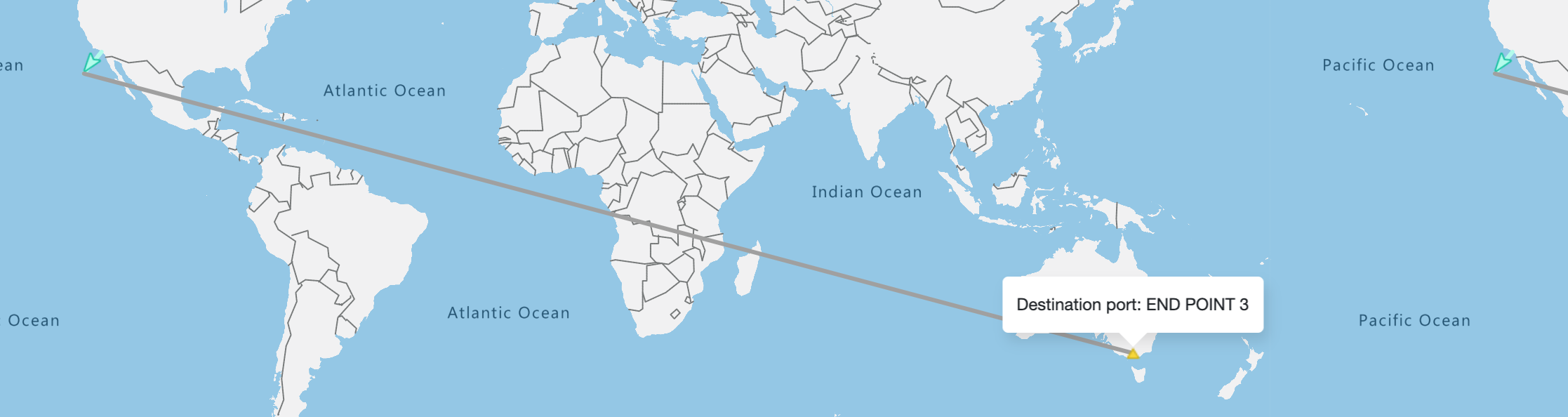
Am trying to plot direct line between "green arrow location"(right top corner) to "destination popup point". But it's moving all around world as shown in picture. Any suggestion? Please find image for reference.
Other lines whose points are not on world edges are working fine.
' cx='32' cy='32' r='32' /%3E%3Ctext x='50%25' y='55%25' dominant-baseline='middle' text-anchor='middle' fill='%23FFF' %3EAM%3C/text%3E%3C/svg%3E)
@welcomenxj Welcome to Q&A forum!
How exactly did you draw the line? Did you try from left to right?
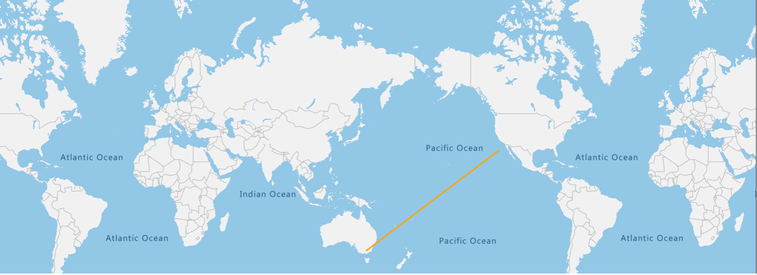
I just tried with the sample code available here: Draw Line and able to draw a line between the points you mentioned.
Thanks @AshokPeddakotla-MSFT for responding. Yeah, even i want the same to cross pacific instead of what am getting. Am using "azure-maps-control": "^2.0.26" npm package in angular application My code looks like this - –
public renderLineLayer(layerId: string, lineColor: any, dataSet: any) {
this.userDefinedLayers.push(layerId);
const lineDataSource = new atlas.source.DataSource();
this.mapInstance.sources.add(lineDataSource);
dataSet.forEach(linePoints =>
lineDataSource.add([new atlas.data.LineString([...linePoints])])
);
this.mapInstance.layers.add(
new atlas.layer.LineLayer(lineDataSource, layerId, {
strokeWidth: 3,
strokeColor: lineColor
})
);
}
my 'dataSet' in above code is 'Array' of 'Array of line points'.
Here are my line points for line with issue -
[{Lng: -118.1948, Lat: 33.767109}, {Lng: 144.9586, Lat: -37.848381}]
@AshokPeddakotla-MSFT
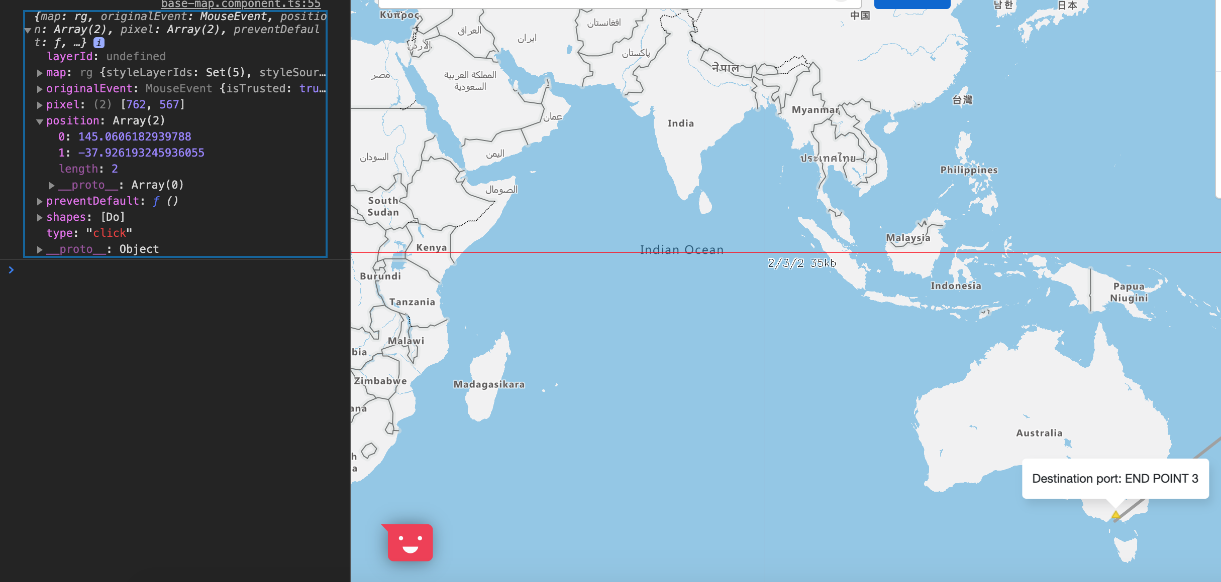
I believe, i understand the issue now but still don't have solution for it. I have added 2 images 'third quadrant coordinates' and 'fourth quadrant coordinates' for your reference. See the 'position' coords in console and how they are varying when popup point is clicked, depending on its position in map.
Why it is not returning the same co-ordinates irrespective of map position? I think answer to this will help to fix this issue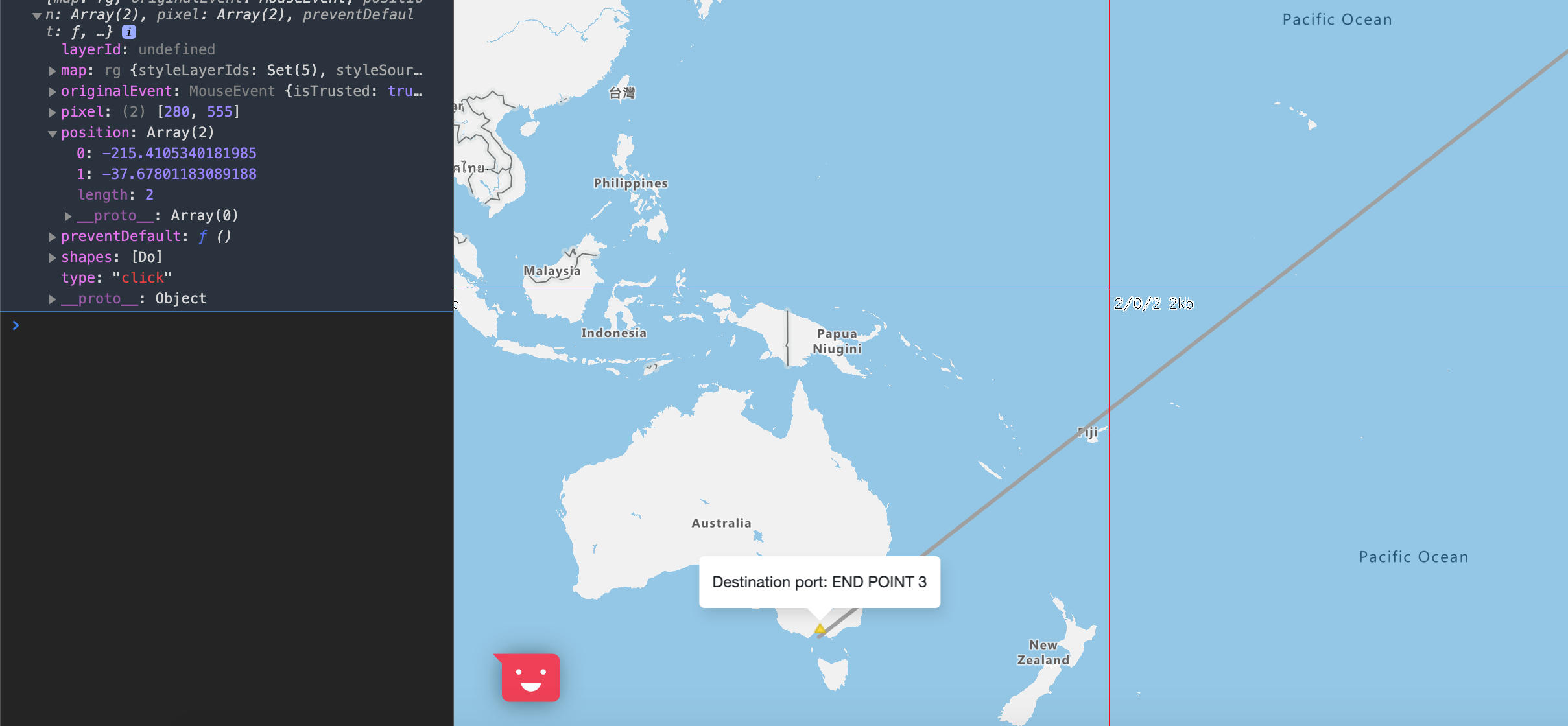
I see the active conversation with Ricky on your Stack Overflow query, kindly follow up to avoid duplicate efforts.
thanks for the response from Ricky. With his last response, am able to understand what SHOULD be happening under the hood. But I don't understand why its not happening for me when i try to cross pacific with these line coords from north america to melbourneline co-ords [{Lng: -118.1948, Lat: 33.767109}, {Lng: 144.9586, Lat: -37.848381}]? Is there any Map configuration which i need to enable to draw direct line between these two points crossing the pacific?

Managed to reproduce the issue and after talking with one of our architects I was reminded that the GeoJSON specification does not allow shapes to cross the antemeridian. I'm not a fan of this, luckily there are a few ways around this:
Options 1:
Option 2:
Here is a code sample showing all two options:
EDIT: Site doesn't let me copy in code or attach the file, I've uploaded the code here: https://github.com/Azure-Samples/AzureMapsCodeSamples/blob/master/AzureMapsCodeSamples/Experimental/Lines%20that%20cross%20the%20Anetmeridian%20.html
Site doesn't let me copy in code or attach the file, I've uploaded the code here: https://github.com/Azure-Samples/AzureMapsCodeSamples/blob/master/AzureMapsCodeSamples/Experimental/Lines%20that%20cross%20the%20Anetmeridian%20.html