Azure Cosmos DB
An Azure NoSQL database service for app development.
1,521 questions
This browser is no longer supported.
Upgrade to Microsoft Edge to take advantage of the latest features, security updates, and technical support.
' cx='32' cy='32' r='32' /%3E%3Ctext x='50%25' y='55%25' dominant-baseline='middle' text-anchor='middle' fill='%23FFF' %3ETE%3C/text%3E%3C/svg%3E)
Hi there,
We are using Azure Cosmos DB to store our telemetry data. We have implemented a (geo zone/ geo-fence) feature where we have to check if a point is within a Polygon. To do this, we are using ST_WITHIN(gps_point(GeoJSON), user_created_polygon(GeoJSON)).
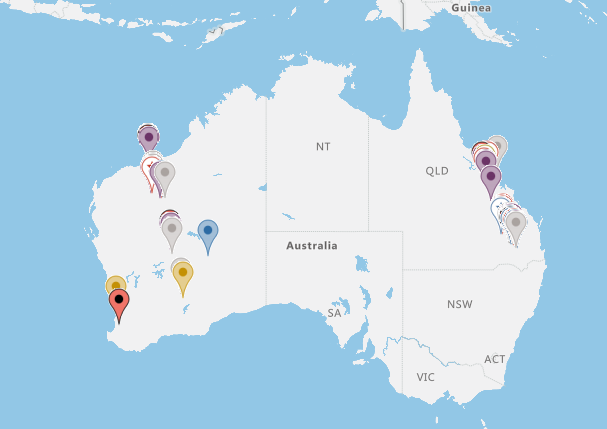
Without any geo zone filtering the map looks like this,
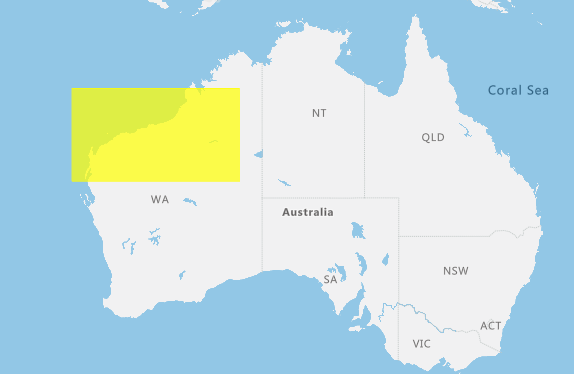
When we put a Rectangle type geo zone, It works perfectly,
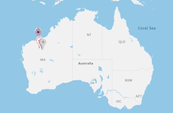
But when we put a custom Polygon shape the filter doesn't work anymore.
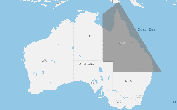
We couldn't resolve, Why this issue is happening. Our Cosmos DB is set to Geography as a geoSpatial configuration.
We have a similar issue for Circle shape as well, for which we use ST_DISTANCE
We are using Azure Maps to plot our data.
It would be really helpful If the community could give us some lead on where we should configure or change to make this work.
Thanks
' cx='32' cy='32' r='32' /%3E%3Ctext x='50%25' y='55%25' dominant-baseline='middle' text-anchor='middle' fill='%23FFF' %3ENS%3C/text%3E%3C/svg%3E)
@Tahmid Eshayat
We are checking this and working with our PG team regarding this.
In the meantime can you share the the following details:
1) Index Policy definition
2) Sample Data
3) Sample Query
.Please send the same to this email id with subject as "Attn:Navtej Singh". Also if you are following document for this , please get back to us with that as well.
Thanks
Navtej S
Please convey if you need further help regarding this. If yes please email the details as asked in previous comment.
Thanks
Navtej S
Hello there @Navtej Singh Saini ,
Glad to get a response from the cosmos team. I have sent an email with sample data and queries.
Hoping to get a positive response.
Thanks for the support
Here is the response from our PG team.
Points within a Polygon must be specified in counter-clockwise order. A Polygon specified in clockwise order represents the inverse of the region within it. Learn more here.
They noticed that in the first query you sent over, the Polygon coordinates defined are clockwise order. Is this intended?
Keep in mind that this is a valid Polygon (ST_ISVALID will return true). Defining a Polygon in clockwise order defines the area that is the inverse of the region within the polygon which might account for their unexplainable query results.
This is also covered in the geospatial section of our query & indexing lab in this document.
Please let us know if you have any other question regarding this.
Thanks
Navtej S
Were you able to check the suggestions from our Product team. Please do let us know if you need any further help.
Thanks
Navtej S
Were you able to check the suggestions from our Product team. Please do let us know if you need any further help.
Thanks
Navtej S
Sorry for replying late. Yes, we managed to fix the issue from the product team suggestion, also @rbrundritt suggestion.
We used ST_ISVALID from the server-side to validate the geo zone. Also, we used turf.js to make the geo zone to follow the right-hand rule. That ended up fixing the issue.
Thank you to the whole team for pointing out the issue.
Thanks
Tahmid
We are glad this is fixed for you. Please do raise a question Q&A if you have any other question.
Thanks
Navtej S

If the polygon is drawn by the user, it is possible that it isn't a valid polygon or that it represents the opposite area of what is being rendered. Azure Maps uses GeoJSON and renders it based on that specification, which is fairly relaxed, where as the geography objects in databases typically require polygons to have a specific ring orientation (counter-clockwise order), the same first and last coordinates, and no overlapping edges. Try using the ST_ISVALIDd or ST_ISVALIDDETAILED functions to verify if this is the issue: https://video2.skills-academy.com/en-us/azure/cosmos-db/sql-query-geospatial-query
From cosmos perspective, Yes you're right, ST_ISVALID and ST_ISVALIDDETAILED gives us false for some polygon. Even though it looks completely fine visually. I think if we stop the user creating this in runtime. This may solve.
But I will follow up here.
Thanks
Thanks for sending the data. We are checking with cosmos team.
Do check about the results you get if you stop user from creating the polygons in runtime.
Thanks
Navtej S